© 2000-2023 - Enkey Magazine - All rights reserved
ENKEY SNC - VAT ID IT03202450924 / REA Code CA253701 - Phone. 078162719
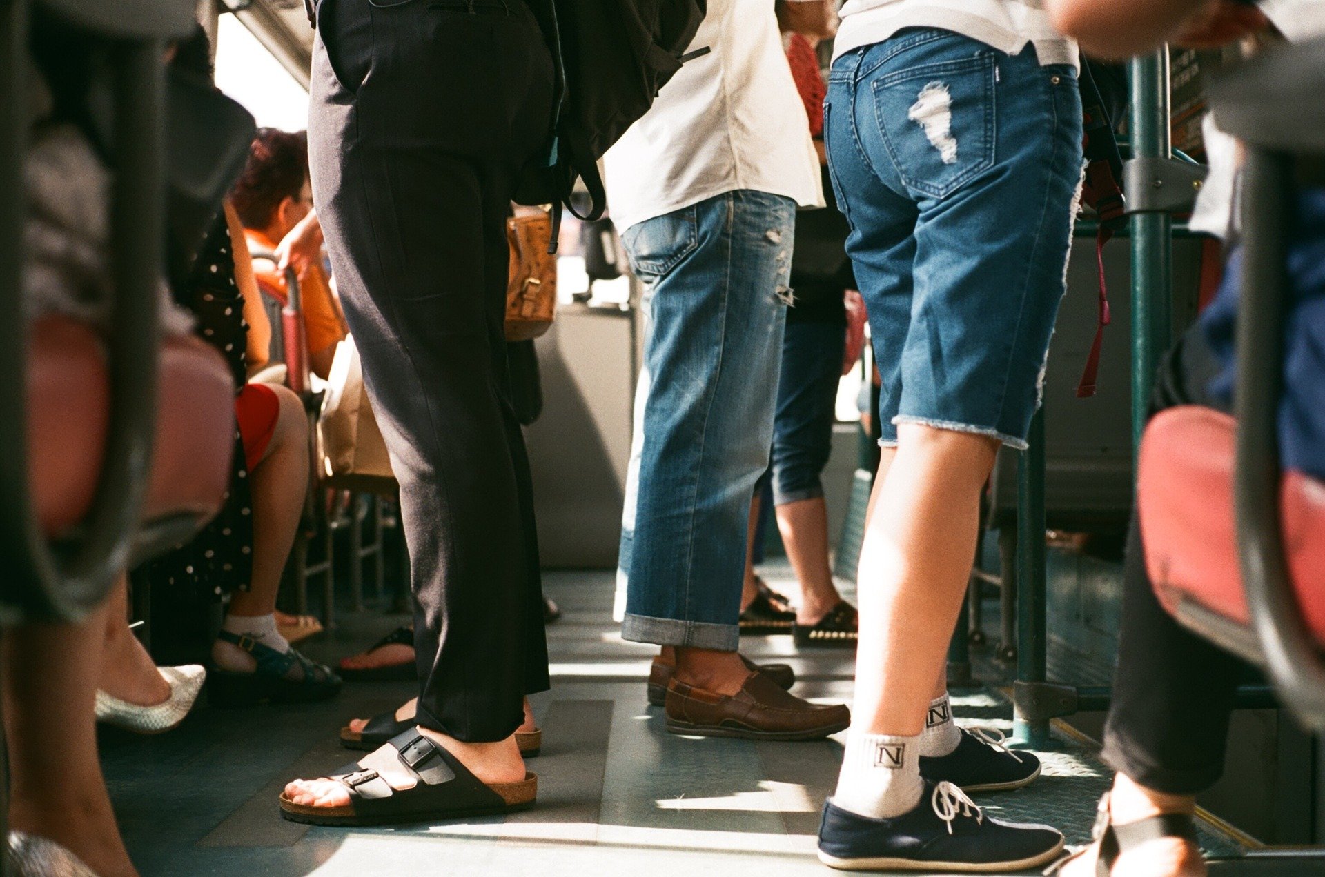
After the ways dedicated to the bikers, Google Maps proposes two new functions dedicated to who uses the public transportation. Moving with the public transport is easy and practical, besides than ecological, but not when there are unexpected delays. Or even worst when the bus is late, but we find it busy, too busy even to think to ride it.
The new functions of Google Maps
For this reason Google thought to this new functionings for one of its most used app: Maps. The possibility will be so the one to know in real time the time of the arrival of the bus and even if there are sits available. No more problems so, especially in case of traffic, or maybe during the strikes.
The possibility to see the arrival’s times isn’t not really new, in some cities, thanks to the information taken from the transport’s companies, was already usable. Surely, it had some restrictions, while instead the new functions of Google Maps doesn’t need to get infromations from third parts and it’s completly autonomous.
Furthermore the most interesting thing is the one to can see the whole map to understand which is the best bus to take. This allows us to observe the traffic and to check the way of every bus.
For now this new function of Google Maps about the delays’ forecast will be available only in few cities: Naples, Palermo, Venice and Trieste will be the first lucky ones.
About the possibility to know when the bus is too busy (which is maybe the most interesting new) for now it will be possible to use only the datas collected by the previous runs. The data so isn’t in real time and it could give fake positive. The tester cities for the busy function will be for now: Rome, Milan, Turin, Padova, Bologna, Verona and Florence.
If you are anxious to try this new functionings, you don’t have to do nothing more than upgrade the app on your smartphone.
The possible aspects of this new functions
But with all of this datas what can we do? Besides to enjoy a less crowdy bus because we decided to the take the next one, is it possible to use them for something else? Theoretically yes.
The best usage that we can do with the datas collected by Google Maps but it’s something we can do it by ourselves. Infact the transports’ companies are the one that should access to this datas to better regulate the flow of their own buses. It’s not only to avoid that the buses will get busy, but even to avoid to let too many buses travel when there are less people.
The best thing will be to improve its own transport’s service according to the real usage. In Turin was introduced, for example, the method of the Bip Card, a ticket that uses the technology NFC and that needs to be stamped on every bus taken during the travel.
This allows to understand the real turnout of people and to regulate the usage of the buses, exactly like Google Maps could do. The idea was the one to increase the affluence in case of busy buses and to decrease them in case they are too empthy. A saving of buses in some cases is surely an increase of tickets’ selling, due to the most efficient service.
The problem, though, is that the counted tickets don’t always are the real travels. For example not everyone does the ticket, especially on some buses too crowdy. But it isn’t to underestimated the case where the bus is extremely busy and not everyone will be able to stamp, by creating at every stop a parade of tickets passed hand by hand until the ticket validation machine.
We hope so that with the introduction of this new functions of Google Maps, we can help even the public transportation for a most efficient and ecological management of the service.
This post is also available in:
 Italiano
